
The Traveler Loop;; Baxter State Park
- Amanda Page
- Aug 19, 2022
- 3 min read
To access the Traveler Loop you will enter Baxter State Park through the North Entrance using Exit 264 on the interstate. The preparation for this hike is very similiar to Katahdin. It is a long strenuous hike to be fully prepared for the change in terrain and possibility of weather changes. Please note, dogs are not allowed anywhere in Baxter State Park.
The easiest way to access the South Branch Campground parking area (which is where you will want to park to hike this loop. There is a bathroom in the parking lot and parking reservations are not required) is best accessed through the Matagamon Wilderness Gate. I highly recommend either staying here or at least grabbing food after you finish this loop. Their staff is incredibly friendly and their food is AMAZING! If you are down for an awesome burger on homemade bread, this is the stop for you! (I will admit that their baked goods are also very good, try a whoopie pie, you won't be disappointed!) Click here to access the Matagamon Wilderness website!


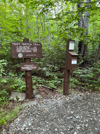


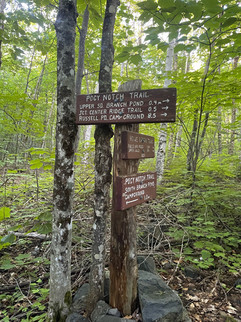
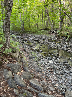
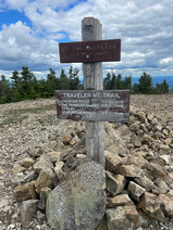
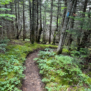
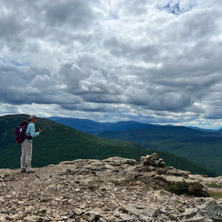
The Traveler Loop summits three peaks: Peak of the Ridges, The Traveler and North Traveler Mountain. The Traveler Loop begins with the Pogy Notch Trail (1.5 mi.). After one mile you will make it to Howe Brook where you will cross and see a junction sign where the Ridge Trail will be .5 miles away.


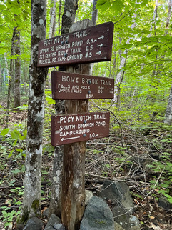


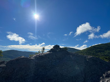
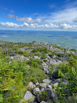
You will then hook onto the Center Ridge Trail (2.1 mi.), which brings you to your first really nice overlook at .7 miles and then to your first peak, The Peak of the Ridges. The Junction for the Traveler Mountain trail will be 2.1 miles from this point but you will summit The Travlers at just 1.2 miles from the Peak of the Ridges.


Continuing on the Traveler Trail (3.7 mi.) and Traveler Mountain, North Traveler will be 2.5 miles away.


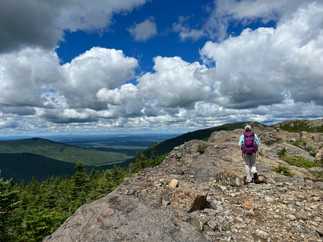


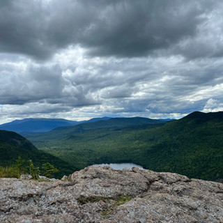
You will finish the loop with the North Traveler Trail (2.6 mi.). The descent will be a little rough on the knees but you get some beautiful views most of the way down. Please plan the trip accordingly and try not to come out in the dark on this one. Without the proper gear, it could be incredibly dangerous with the exposed portions and some of the loose rocks.


Map Courtesy of the Baxter State Park Website:

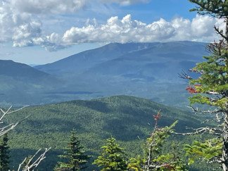
Once again, this is a strenuous and long hike with a lot of exposure above treeline. Once you walk through the campground area from the parking lot, the first sign nothing the Traveler Loop is marked as 10.6 miles round trip. Prepare for this one like you would Katahdin and you should be fine. Weather can change very quickly in the mountains but this hike is gorgeous and highly recommended doing at least once! This is what I had logged during my hike which I believe was a little off because I had my phone in airplane mode to save on battery life. I logged 11.02 miles through my apple watch.
The hike can be done in either direction, however the rangers do suggest that you hike in the counter-clockwise direction which was the way we went during our trip. We did debate going clockwise, as Crystal, my friend I hiked the loop with has always gone counter-clockwise. However, I am glad we stuck with counter-clockwise. Once you are done with the large loop portion, the walk back to the parking lot is incredibly short. Although, at the end of this loop you feel a sense of accomplishment, you are also happy to see the parking lot again!
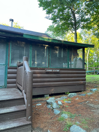
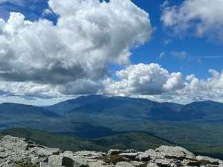
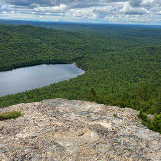
The hike requires a total elevation gain of 3,700 feet, only 400 feet less than required of a Katahdin hike on the Hunt Trail. We saved taking in the beauty from the dock near the Ranger Station of South Branch Pond for the end of the hike. What a great way to end a beautiful day in Baxter State Park.

Happy Hiking,
-Amanda


Comments