Mount Waldo via The Quarry Trail;📍Frankfort
- Amanda Page
- Apr 27, 2022
- 4 min read
Updated: May 19, 2022
This one was a great spring opener hike for mileage and elevation gain! Lately I have been trying to stay as local as possible and I will definitely say, this one did not disappoint! It is kind of fun to find great trails within an hour of home. Some of these have been on my list for years but I have had my eyes set on some of the popular ones that seem to be so far away.
Originally we had planned on starting on the South Trail but upon arriving, it looked as though there was a lot of land being cleared so we weren't 100% sure about being able to hike this trail. (It also starts you in a section that seems like you are on someone's front lawn). There is a parking sign a short distance up the road from the trail, however, we just decided we would start on a more well known trail. We went backtracked about 2.5 miles to the signs for the quarry trail instead. We did meet a couple of nice women who had a great idea and did a car spot. They parked one vehicle at the south trail and one at the Quarry Trail. Started on the South Trail, ended coming out the Quarry Trail and getting the other vehicle once they had finished.
The trailhead for the Quarry trail is roadside parking on the Mount Waldo road. However, it is very low traffic and a dead end at the gates for the trailhead so no need to worry about getting out of a vehicle on the side of a busy road. I would rate this trail as moderate because of the elevation gain overall for the mileage and for the fact that the trail isn't really marked well. The worst spot I encountered for needing markers was at the quarry so you do need to pay attention in that spot. If you have a couple hikes under your belt though, I would say you will be fine as it didn't take us long to identify which direction to go.
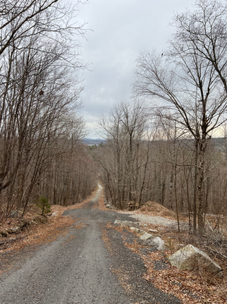
The start of the quarry trail is a road and it is fairly steep. Definitely gets your blood pumping right off the bat by trekking 500 ft of elevation gain in the first mile. After the first mile it begins to even back out and be more tolerable. The trail is filled with great views from the first mile and on. The trail is very interesting, definitely not a snoozer!
Once you get to the quarry this is a great spot to stop if it is a hot day or you would like to enjoy the water as most of it looked very clear. The quarry also gives off some city like vibes with the graffiti. Some of you will love the graffiti, some of you will hate it, I'm sure there are very mixed opinions on this. I would say this was a very happening spot back in the day and might be why there is now a gate on this road. However, there are a couple of sections when walking up the slab rock that there are a few inspirational messages painted onto the rocks like "you matter", "keep going" and "almost there".
You will walk down through the quarry and just as you get to the end, it will feel like you should go left, however, you will stick to the right and climb over some rocks to the top. You will se a very obvious path that will then lead you towards the left where you will head towards the tower on the summit trail. I would recommend you download a trail map for this portion if you are new to this hike. (See all trails, I have my map attached at the bottom of this post)
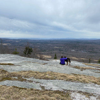
Once you make it to the tower you get 360° views and on a clear day it is said you can spot Katahdin in the distance. I went on a day that had cloud coverage so we did not get a chance to see Mama K. Coming back down the trail, we did hook onto a small portion that brought us our around the slab rocks that had water running down them which was defiinitely nice so we weren't coming down wet rocks. This section is also not marked really but there is a log that veers you that way in the ground and looks like obvious trail.
Overall, this trail is probably for someone somewhat comfortable on trails that don't have spectacular markings but is doable if you are comfortable with offline maps on All Trails. With this trail only being an hour from where I live, I will probably be back. The views are great pretty much the whole way and once you navigate the trail once, it should be pretty easy to navigate these trails again. Our total time on the trail was about 2 hours and 15 minutes. We took a couple of breaks for some photos and our overall moving time was just about two hours. This trail gave us just over 1,000 feet of elevation gain and was 4.2 miles in length. If you are looking for a trail fairly local to central Maine and don't want the added length to walk into Great Pond Mountain during mud season road closures, I highly recommend this hike!

Happy Hiking
-Amanda & Brock


Comments