
Gulf Hagas; The Grand Canyon of Maine;; 📍Brownville
- Amanda Page
- Aug 4, 2022
- 3 min read
Listed as being in Brownville, you head out of town on route 11N for 8 miles until you reach the KI Road. After 6.5 dirt road miles, you will check in at the North Maine Woods Gate. There are fees associated with the gate which varies depending on if you are a Maine resident and if you plan on staying more than a day, however, as a Maine resident at the time of this post, our day fee was $11 per person. Once you check in at the gate, you will bear right on the Katahdin Iron Works road and travel for an additional 6 miles of dirt roads. Signs are very easy to follow to get to the main trailhead.


Gulf Hagas also lies within the 'Hundred mile wilderness' which is the last 100 mile stretch of the Appalachian Trail. If you have ever stepped foot on the AT, you know it is magical. Speaking with a few thru hikers on their way north, their last stop had been in Monson and they would have to make what they believed to be around a 6 day stretch to reach the Summit of Mama K.
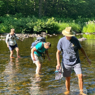
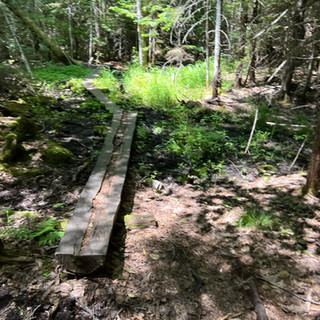
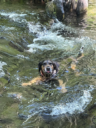
The trailhead has plenty of parking if you get there early. (There is also a separate trail head which would put you at the head of the gulf side of the loop) which would make it so you odn't have to cross the river at the beginning of the trail, however I think the crossing is part of what makes the hike so special.
The river crossing is so close to the beginning of the trail that I put on my watershoes at the trailhead and waited until after the water crossing to put my hiking sneakers on. There is an area on both sides of the river crossing to be able to sit down, dry your feet and swap out your shoes. I recommend that if you can't keep your shoes on the outside of your pack to dry, to bring a plastic bag to put your water shoes in.


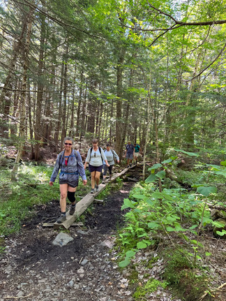
The AT will split away from the Gulf Hagas Area just before the second river crossing which is much easier and manageable without having to change your shoes (unless you fall in of course). We veered left on to the rim trail instead of going straight to the Pleasant River Tote road. (I recommend this route if you are taking the loop so that you do all of the hard sections with a view first. Taking the tote road out is a breeze and nice after some of the up and downs of the rim trail.)


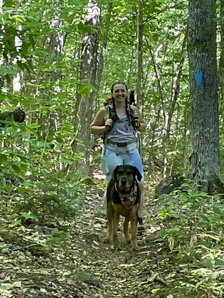
First you will see Screw Auger falls. There are a couple of spots you can view the falls from or you can take the steep trail down to the falls and get up close. I didn't find this section very dog friendly so I stayed up top with Brock and looked at the falls from a distance.
Screw Auger Falls:


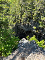
Hammond Street Pitch is the only lookout I did not do. This brings you to the deepest point of the Gulf, which is 100ft to the stream.
Cole's Corner is just a small overlook point.


The Jaws head down the side trail for 250ft to get a nice view of the Jaws.


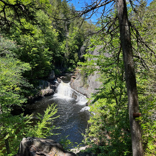
Buttermilk Falls there is a short side trail that leads you to a nice view of Buttermilk and a small pool upstream.


Billings Falls check out the side trail that leads you to the outlook, it is worth it.


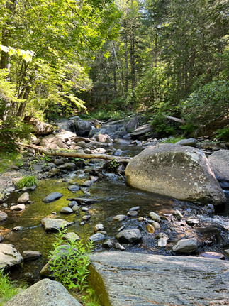
Stair Falls is a series of drops that resemble a stair case.


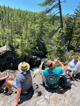
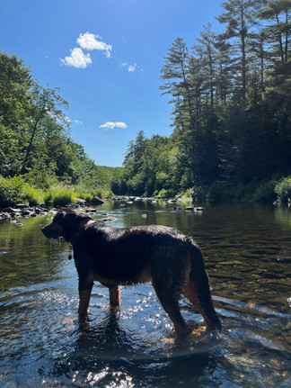
Head of the Gulf on the Rim Trail was the perfect spot to break for lunch. Although a few members of the group wanted to stop for a couple of snacks prior to this point, this is the best spot (if unoccupied) for lunch. There is a nice section to swim and cool off and plenty of seating for a decent size group to spread out and relax. Our group got to spend an hour here and it was absolutely perfect.


After the head of the Gulf, you connect back onto the Pleasant river tote road which is nice and flat and a great way to end the loop.


Taken from the North Maine Woods Website:

Trail Descriptions:

This trip is something every hiker must do at least once. The remote area and the views are unmatched. The rim trail has a lot of shaded areas but there are some exposed areas as well. Overall, this was a great experience and I will probably head back there next year!
Happy Hiking
Amanda & Brock


Comments