
Exploring Carrabassett Valley;; Family Friendly Weekend Itinerary Ideas 🐕🥾🌄🥂💎
- Amanda Page
- Jun 6, 2022
- 8 min read
I love planning adventures! Weather made it so I had to flip flop what we did on check in vs departure day, but it all worked out in the end! Check in time to our cabin was 3pm, so I planned a couple of fun things!
Day 1;
New Portland Wire Bridge
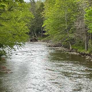
On our way to our cabin rental, we went through New Portland where we found the beautiful wire bridge! This is one of four wire suspension bridges in Maine built in the mid 19th century! The official town history of the bridge states that it was built in 1864-66 by David Eider and Captain Charles Clark. The bridge was last rehabilitated in 2009-10; its towers and cable are original. One of the coolest parts about this bridge is that you can still drive across this one lane, 188 foot long wooden planked bridge that crosses the Carrabassett Valley River! We got out on the other side to park in what looks like an old baseball field. There was a gentleman fishing in the river and a woman enjoying the sounds of the river in her beach chair.


Just under 11 miles and 15 minutes away from the wire bridge was our first hiking adventure for the weekend, Reed Brook Falls.
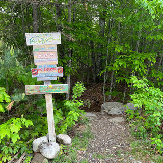
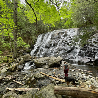
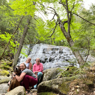
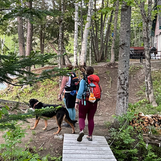
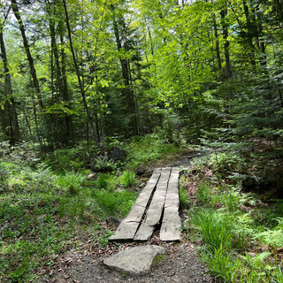
Reed Brook Falls
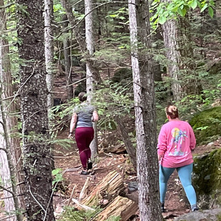
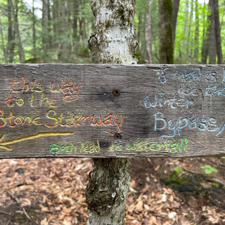
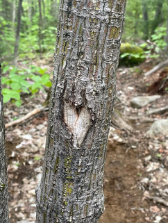
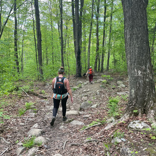
Reed Brook Falls is such a nice little gem for the area! The overall hike is considered easy on All Trails. There are some roots and things to avoid, but other than that, almost anyone can access this trail! We spent about 40 minutes overall on this well maintained trail system.
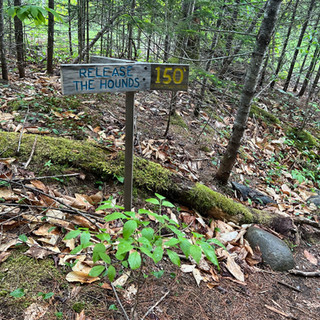
The trail starts in the same parking lot as the Carrabassett Valley Veterinary Service in Kingfield. If you look to the left of the parking lot, you will see a small sign for the trailhead parking. They ask you to please keep your dogs leashed in the parking lot, as it can get a little chaotic. Once you get onto the trail system a little ways, there is a cute little sign allowing you to "unleash your beasts" (as long as they are well behaved).


The trail is an out and back and is about 1.3 miles overall with a little exploring. There is a small loop near what they call 'Jericho Steps' but that had been washed away when we went in the spring. So we just kept walking towards the falls. The falls are beautiful and really cool because you can actually walk right up to them, unlike other places where you can only see them from a distance.


After we finished the Reed Brook Falls trail, we went straight to the cabin which was only 8 miles, and 1o minutes away from our cabin!
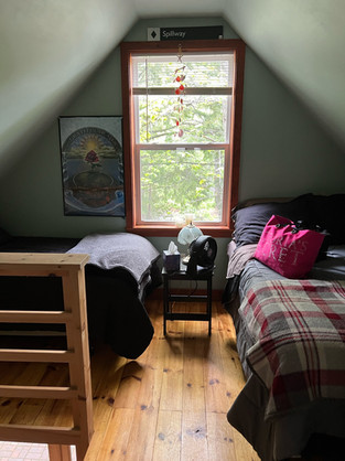
Staying At Valley High
From the moment that I stepped into the Valley High Cabin, it just felt like home. You never want to leave, it is just so perfect. Pictures don't even do this property justice. If you are obsessed with it from the pictures, you must book and spend a couple nights there. It is simply magical.

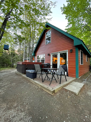

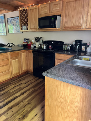

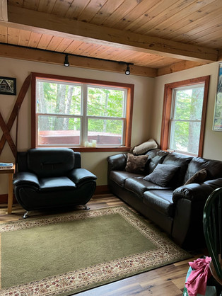


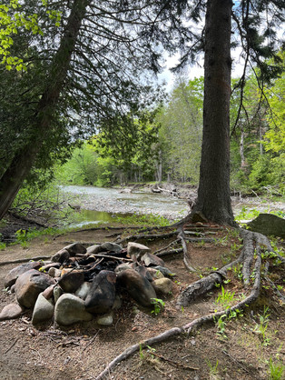


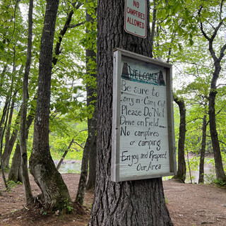
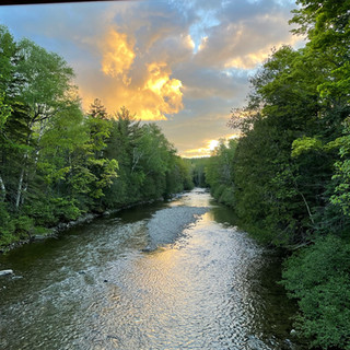
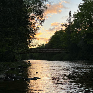
The property sits directly on the Carrabassett River. You walk out the back door and it is all view! A hot tub located just outside the back door on the patio, a picnic table and a small fire pit. If you walk down to the river you can also see a bridge that is part of the Maine Huts and Trails system! One of the best parts was that just off to the side of the fire pit is a private trail with direct access to the Maine Huts and Trails system! The private trail from the cabin puts you directly onto the Campbell field entrance.


Here is the direct link for booking a stay at Valley High! ➡️ Stay At Valley High
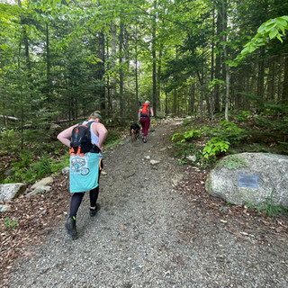
Maine Huts and Trails System
The Maine Huts and Trails system is a well maintained system that includes over 80 miles of trails inviting hikers, mountain bikers, paddlers, fishermen, snowshoers and so many more to enjoy all of the recreation options within their system and to promote a boost in the local economy. The system offers public access year round to visitors of all ages and abilities. (Note: some trails are closed to four legged kids during the winter months to protect cross country skiing trails).


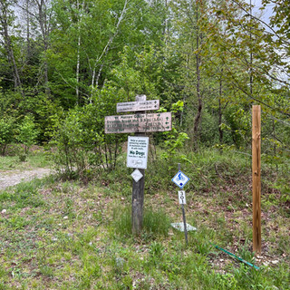


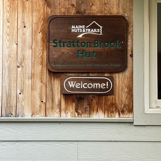


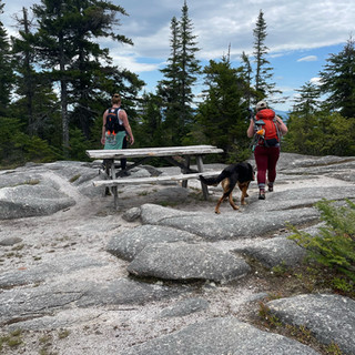
Following the map I have provided, this is the direct recording from the cabin to the Stratton Brook Hut going up Oak Knoll and coming back Newton's Revenge. This route was just about 6.75 moderate miles. A lot of the beginning has switchbacks to make it more interesting for those on bikes. I did go up the access road when we got closer to the hut and we got all of the views as the sun was beginning to set. You can plan to be out on this route around 3 hours depending on pace and how long you stop for pictures.
Day 2;
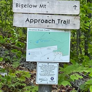
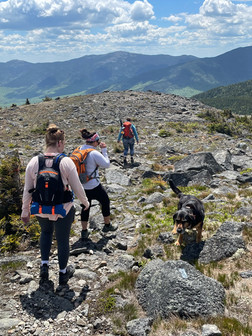
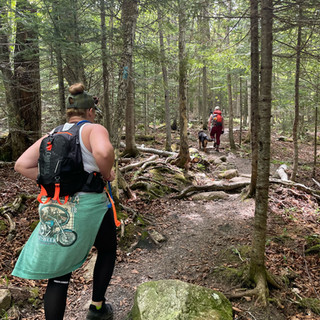
Burnt Mountain
I saved the hardest mountain and activity for the second day. This gave us time to wind down at the cabin after the hike. Burnt Mountain trail head is accessed on one of the roads amongst the Sugarloaf condominiums. The trail head is only 5 miles from the cabin which makes it even sweeter. The views were amazing and so close to the cabin, you couldn't ask for any better! (Mind you, there are SO many mountains to choose from in the area that take hardly any time to get to from the cabin).
Burnt Mountain is rated as 'Hard' on AllTrails because of it's short mileage but high elevation gain. Round trip was about 5.5 miles and we were on the trail for just shy of 6 hours. Mind you, we spent a lot of time at the summit with drinks, snacks and just enjoying the view! Our overall moving time was about four hours.
We did end up on the wrong side of the trail fairly close to the beginning as there was a tree down that had a double marker that was supposed to veer right, however we kept going straight as there was another tree right behind it with a blue marker. (Looking far right you would have seen the other trees with blue markers but it is easy to miss) This kept us on the access road for quite a ways until we found the Burnt Mountain trail sign again just after you stop walking next to the river on the actual trail.
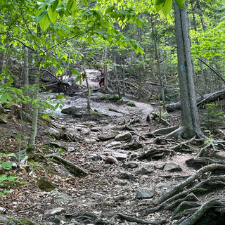
Once you get past the river portion you start to climb straight up. There are a few sections that flatten out but for the most part, you are gaining elevation. Once you get above the tree line, you have to really pay attention to some of the lines that are used for drop in skiers and also look for the cairns to lead you the rest of the way up the mountain. It did seem like there were extra cairns added in spots where they shouldn't be so definitely look up ahead to make sure you are on the right path. On the way up we saw a large moose print in the mud but missed out on seeing the actual moose.
There are a few false summits but every bit of false summit is still beautiful! I remember the group stopping at one of the false summits and I pointed out where we were going and got some big eyes staring at me. Once you make it to the actual summit, which is just a rock pile without a sign, it is definitely worth it! This is probably one of my favorite hikes to date because of the challenge and the views at the end. However, it doesn't take you all day which is nice.
Coming back down, we hooked back onto the correct trail that we missed next to the river which was really pretty but I was kind of glad we made some of a loop out of the trip. I say this all of the time but, I really do not like out and backs! This broke the trail up some which was nice! You do end up crossing the river so you will have to watch your step some but it was pretty manageable. Aside from the bugs swarming almost the whole trip, this really was the perfect day for a hike!


Day 3; Rangeley Adventures
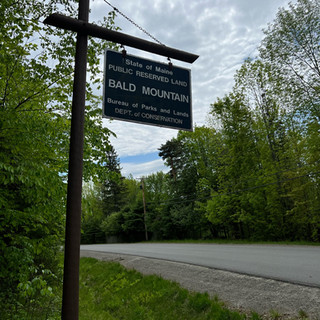
Hearing great things about Bald Mountain in Rangeley, once we packed up the cabin on our departure day, we made our way towards the mountain! Getting to Bald Mountain from Valley High is about 40 miles and took just under an hour to get there, including a stop at the store to refill the ice in our cooler filled with leftovers. If google maps tries to mess with you mid trip like it did to me (took me down a random camp road) dismiss it. Just head straight on Route 17 until you turn left onto Route 4 in Oquossoc.
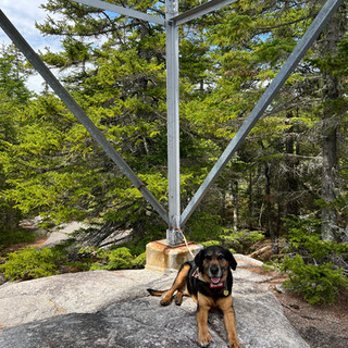
Bald Mountain
Bald Mountain is a 2.7 mile out and back trail that features a tower that gives you all of the views at the summit. This trail starts out fairly easy which I think confuses people because the trail does become a little technical. You will have to climb up over some roots, rocks and slabs that can be slippery when wet. There are some steep sections but this trail has a nice variety of terrain. This trail is far from boring and is considered moderate for good reason. If you are scared of heights this might not be the trail for you, only because you won't get to take in all of the beauty this trail truly has to offer.


We spent two and a half hours on this trail with about 40 minutes where we weren't actually moving. We had some down time at the top because of how busy this trail was and you have to take turns going up the tower during busy hours. We did this trail on Memorial Day so I am assuming this also contributed to how busy the trail was. However, it was nice because it wasn't so busy that we had to hike with other groups because of congestion. Overall, this trail is very well marked and I recommend checking it out!


The parking lot had cleared out some when we got back to the vehicle so we relocated to some shade and dug into the cooler for some lunch in the parking lot. It was so peaceful and much needed after this hike! The hike didn't leave you breathless but definitely made you feel like you were really hiking the whole trip!
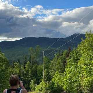
Height of Land
While waiting for our turn at the base of the tower, it was mentioned that we were close by to Height of Land. We added that to our agenda for the day before we made the trip home. From the Bald Mountain trailhead, Height of Land was a little under 13 miles and took about 20 minutes to get there.


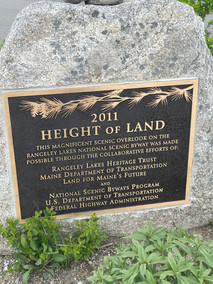


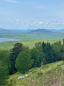

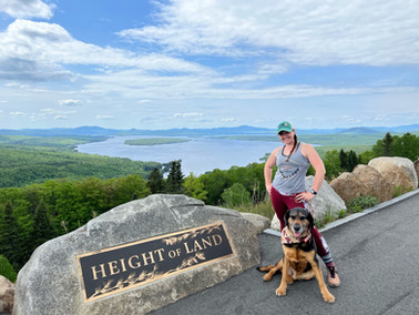

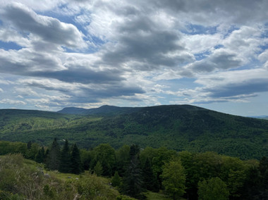


Height of Land is located right off of Route 17. You can't miss it, there is one scenic overlook before you make it to Height of Land and then your final destination. The views really are unmatched! You stand there in awe of the lakes and mountains you are looking out over. There are also some really neat informative plaques places around this destination. Take the time to read them and take in the whole moment. There are some neat, random things to learn.
Did you know that President Roosevelt spent time in Maine hunting and spent a lot of his career taking pride in conservation and protecting natural resources in our country? He established the United States Forest Service, signed into law five National Parks, and proclaimed 18 National Monuments. He placed over 230 acres of land amongst the United States under public protection, As early as 1878, Teddy Roosevelt began his long relationship with Maine and his personal guide, William Wingate “Bill” Sewall of Island Falls in Aroostook County. They spent most of their time exploring what is now Katahdin Woods and Waterways National Monument.


Overall, this was a trip of a lifetime. There are so many fun places to visit that are close by and I can't wait to go back. I recommend that if you have a dog that you bring them, let them explore as well! I encourage you to take a vacation where you can explore the State of Maine. I know I have always taken for granted being from this great state, and I am always surprised by how amazing the state is. I can't believe how many people don't know how great this place is!
Keep exploring!
-Amanda & Brock


A great suggestion — Carrabassett Valley seems like a great place for a weekend with kids and family: nature, easy to moderate hiking trails, quiet afternoons, and new experiences for the whole family.
For me, such vacation plans are a great balance — relaxing in nature on the one hand, and making some exciting choices on the other. If you want to check out both sports betting and online casino games, I would recommend mostbet.az.